Hong Kong Global Geopark
Tags : Nature
Time Required : 4-5 hours
Ways to Experience this attraction
Hong Kong Global Geopark, Hong Kong Overview
Located in Sai Kung, Hong Kong UNESCO Global GeoPark is a large area of natural space made from distinct geological sites. Formerly known as Hong Kong National Geopark, it showcases the exquisite beauty of Hong Kong’s landforms. The park is a combination of the rocky giants in Sai Kung and the sedimentary rocks in the Northeast New Territories region. It also houses a nature laboratory that gives valuable insight into the planet Earth.
The Global Geopark was opened to the general public on 3rd November 2009 and covers an area of 150 square kilometres. It comprises of two distinct regions as well as eight significant sites of geological importance namely islands, cliffs, sea caves, volcanic rocks and tidal spit. The hexagonal rock formations in Sai Kung are internationally reputed for its geological significance. New Territories area flaunts the collection of sedimentary rocks that showcases Hong Kong’s rich geological history. Hong Kong Global Geopark is a result of volcanic eruptions, pressure as well as tectonic movements taking place for millions of years. It was declared a part of the Global Geopark Network by UNESCO in the year 2011.
Read More on Hong Kong Global Geopark
Sai Kung Volcanic Rock Region
High Island
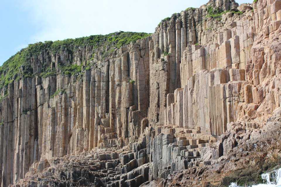
This houses world-class hexagonal columns featuring rare basalt rocks with a pinkish hue. These basalt rocks are formed due to the massive volcanic eruptions taking place in this region. They have a diameter of 1.2 metres and sprawls across an area of 100 square kilometres. The columns resemble tall murals and cover a large part of Sai Kung.
Ung Kong Group
Located in the south of High Island, Ung Kong Island is composed of underlying columnar rocks that give a unique appearance to this jagged terrain. These rocks also result in the formation of sea caves and sea arches along the coast. Ung Chau Group comprises of the Basalt Island, Wang Chau and the Bluff Island.
Ninepin Group
Located in the east of Hong Kong, Ninepin Group comprises of several offshore islands. This region is enclosed by enchanting cliffs created by numerous volcanic rocks. Ninepin Group flaunts hexagonal-shaped columns that have a diameter of 3 metres.
Sharp Island
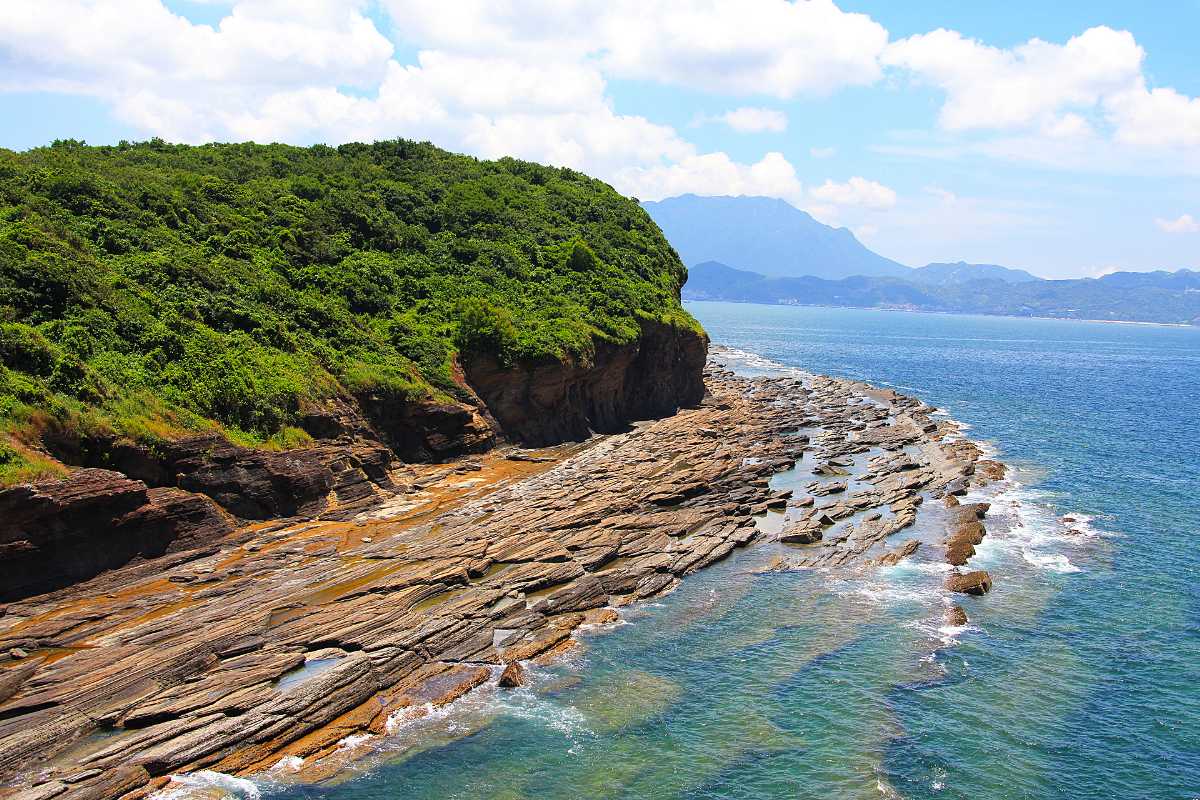
To the southeast of the township of Sai Kung lies the Sharp Island. It is easily accessible by boat from the main town. The area is loaded with sedimentary rocks formed after volcanic eruptions. There is a strip of land (tombolo) that connects Sharp Island to a nearby small island.

Northeast New Territories Sedimentary Rock Region
Double Haven and Port Island
Also known as Yan Chau Tong, Double Heaven is a harbour surrounded by Crescent Island, Double Island, as well as, Crooked Island with New Territories. This region is packed with red coloured rocks formed during tertiary. Port Island is often regarded as ‘Red Earth’ because the ground of this island imparts a rust colour and contains siltstones that are formed as a result of tertiary.
North and South Coasts of Tolo Channel
As the name suggests, this region includes the Tolo Channel’s north and south coast. It is packed with ancient rocks that were formed around 400 million years ago. On the tip of the Tolo Channel, different erosion features can be witnessed. The most famous among them is the Devil's fist. Ma Shi Chau showcases 280 million old sedimentary rocks and Lai Chi Chong contains both volcanic and sedimentary rock that is about 146 million years old.
Tung Ping Chau
Snuggled in Mirs Bay, Tung Ping Chau is an underrated holiday destination. The attractions include picturesque landscape resulted due to wave erosion as well as a spongy rocky structure, shale. This area is usually frequented by the locals.

Tips
- The best way to view the coastal landforms is from a boat
- Avoid going ashore in areas packed with slippery rocks
- Preserving these landforms is important, do not make markings on the rocks
- The terrain is rocky, wear a pair of shoes with good grip
- Sail off to these islands only when the weather is good
- A guided tour offers a better experience
How To Reach Hong Kong Global Geopark
From MTR Diamond Hill Station, take the C2 Exit and board Bus 92
From MTR Choi Hung Station, take the C2 Exit and board the minibus 1A
From MTR Hang Hau Station, take the B1 Exit and board the minibus 101 M to the town centre of Sai Kung
High Island
From the town centre of Sai Kung, board bus 94 or take bus 96R from MTR Diamond Hill Station to Pak Tam Chung. Take Tai Mung Chai and walk to the junction, from there take a right turn to Man Yee Road and keep walking for 9 more kilometres.
Board a taxi from the town centre of Sai Kung or Pak Tham Chung to the Geo Trail
Sharp Island
Take the C2 Exit from MTR Diamond Hill Station and board Bus 92
Take the C2 Exit from MTR Choi Hung Station and board minibus 1A
Take the Exit B1 from MTR Hang Hau Station and board minibus 101M to the pier of Sai Kung. From the pier, take a ferry-ride to Sharp Island
Ung Kong Group
Board Bus 92 from the C2 Exit of MTR Diamond Hill Station
Board minibus 1A from the C2 Exit of MTR Choi Hung Station
To reach the Sai Kung Pier board minibus 101M from the B1 Exit of MTR Hang Hau Station. From the pier, take a boat-ride to Ung Kong Group
Ninepin Group
Board Bus 92 from the C2 Exit of MTR Diamond Hill Station
Board minibus 1A from the C2 Exit of MTR Choi Hung Station
To reach the Sai Kung Pier board minibus 101M from the B1 Exit of MTR Hang Hau Station. From the pier, take a boat-ride to Ninepin Group
Double Haven
Take the Exit B from MTR University Station and walk to No. 3 Ma Liu Shui Landing and board the boat to Double Haven that includes Kat O, Lai Chi Wo and Ap Chau. The boat ride takes around 1.5 hours
Ferry Schedule:
Ma Liu Shui to Lai Chi Wo (Sundays and Public Holidays only)
Ma Liu Shui to Kat O and AP Chau (Saturday and Sunday, Public Holidays only)
